Via Appia. Regina Viarum.

By Rachel Heller
What is the Via Appia?
The Via Appia – the Appian Way in English – is simply a road, but it was built by the Ancient Romans between 312 BC and the 4th century AD, reaching over 650 kilometers in length (400 miles). It was, at first, intended to allow quick movement of troops across Italy from Rome to Capua as the Roman Republic gradually expanded its territory. Later the republic extended the route as far as the port of Brundisium, now called Brindisi. Being able to move troops and equipment quickly contributed to the extension of Rome’s power into what is now the Middle East.
Disclosure: This article contains affiliate links. Making a purchase through an affiliate link will mean a small commission for this website. This will not affect your price. Privacy policy.
Later, in 109 AD, Emperor Trajan added a branch to the road connecting Beneventum to Brundisium, along an easier route than the original Via Appia connecting the two. This is called the Via Traiana.
Over time, the roads became arteries for trade in general, and anyone could use them without paying tolls. The route included bridges, but also other structures for public use: things like fountains, temples, bathhouses, accommodations, amphitheaters and aqueducts. Towns grew and prospered along the route and Romans built tombs and necropolises along it as well.
In the early Middle Ages the route allowed the spread of Christianity across Italy, and later it carried crusaders to the Holy Land. To this day, it is in use, still often under the name “Via Appia Antica,” though much of it has been paved over and looks like any other road.
Regina Viarum means “queen of the streets,” by the way.
Why is the Via Appia a UNESCO World Heritage site?
The road was a huge accomplishment at the time and influenced the entire Mediterranean for centuries. It is a demonstration of the success of Roman civilization in being able to carry out such a huge project. According to UNESCO, it “shaped the development of the ancient cities it connected or which were associated with it” and the other monuments that were built along it “bear witness to an age-old civilization.” It became “a major vector” in the spread of Christianity and in movement of pilgrims to the Holy Land.
This serial property is not a single road today, but rather a collection of locations where vestiges of the road are in various states of preservation. It includes 21 parts, all listed below.
Many of these locations are not only sections of the road itself, but include other structures along that road: things like, near the “Via Traiana from Beneventum to Aequum Tuticum” section, a partially intact Roman bridge. Today, some also have museums that explain the nearby ruins and hold artifacts found at the site.
What can you expect on a visit to the Appian Way sites?
What I did on our trip to Italy is, first, located all of them on a map, using the latitude and longitude information given on the UNESCO website. These locations are the brown stars on the map below. Since most of the 21 parts are sections of a linear route rather than a single point on the map, the markers aren’t very accurate.
So I studied the map to see what was at or near each one. What I found was that, while some are marked as places of interest on Google maps and some have nearby museums, others show little information. For whatever places I could find nearby that have to do with the Ancient Romans and the Via Appia, I added a green star.
I haven’t seen all 21 parts of this group, but I did stop at ones that were on the way of our road trip and that sounded interesting. At some of them you can expect to pay admission to a museum and to the ruin. For each of this sort, we enjoyed the visit, mostly because signs offered explanations of what we were seeing. At others, there does not seem to be any form of guardianship of the remains, so we just waded through the grass to the ruin and took a few pictures.
Are the Via Appia sites worth visiting?
The vast majority of these 21 locations are probably not worth visiting if you’re not an absolute fanatic about Ancient Rome. Roman history enthusiasts, first and foremost, would like these sites, as would anyone interested in classical art and architecture. Most of the ones we visited had something that might be worth a short stop, but only if you happen to be in the vicinity. For most people, though, only the first part of the site – the Rome section – will be worth any time or trouble.
If Roman-era art is a particular interest of yours, you’re better off visiting art museums, particularly the Vatican in Rome, the Metropolitan Museum of Art in New York City, or the British Museum.
Here’s the list of all 21 sites, starting in Rome: first, the Via Appia sections, and then the Via Traiana sections. I’ve visited numbers 1, 5, 9, 11, 12, 13, and 18. I took the rest of the information below from the relevant place’s website, various other websites, and Google maps.
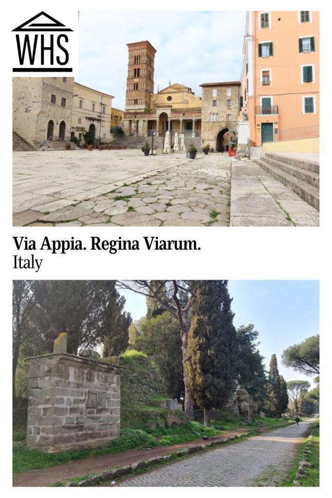
1. The Via Appia in Rome, for the 1st to the 13th mile
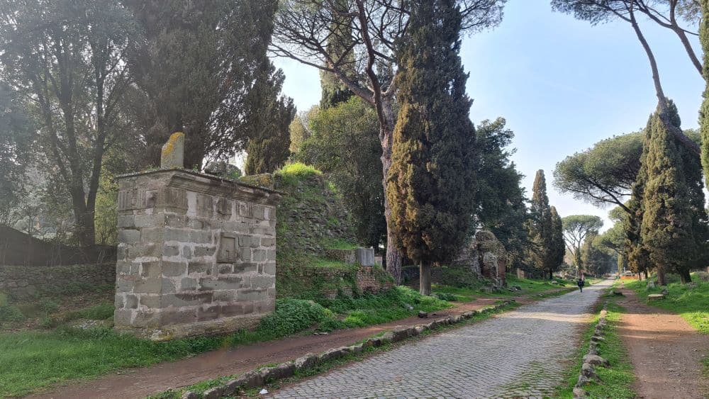
We didn’t walk the whole 13 miles. We did the first five or so (8 km) over two half-days, but we found that there are quite a few things to see in this first stretch of the route, so you don’t just walk it; you stop and see the various sights along the way. In its first few centuries, this part of the route – then and today a suburban area of Rome – was lined with both elegant villas and the grand tombs and mausoleums of the wealthy Roman families.
It’s not completely clear just where the route began when it was built, but I think it was near the Roman Forum. The parts that are worth seeing in Rome are in or near the Via Appia Archaeological Park.
You’ll find plenty of Roman-era structures along the way, many of them tombs, and many of them in pretty poor condition: just a tall pile of rocks. Here are a few of the more extensive locations that are open to visitors, but please note that this list is not complete. Most of them are within the archaeological park.
- The Caracalla baths: a huge thermal complex dating to the 3rd century AD. If you’re coming from Rome, it’s before the park. Website.
- Museo delle Mura (Wall Museum): also before the park, inside the Porto San Sebastiano, a gate in the Aurelian Walls. It covers the history of the fortifications. Website.
- The San Callisto Catacombs: a burial place dating from the earliest Christian period under Roman rule. Instead of burning bodies as the Romans did, they cut body-sized slots in the limestone walls below ground, sealing them with carved stones. They dug additional deeper “galleries” over the following centuries until its closure in the 9th century. About half a million were buried here: many Christians, including several early Popes, but also Jews and pagans. This is not for anyone who gets claustrophobic! Website. Admission fee includes a 30-minute guided tour.
- The San Sebastiano Catacombs: like San Callisto, an early Christian burial place. Website. Admission fee includes a 30-minute guided tour.
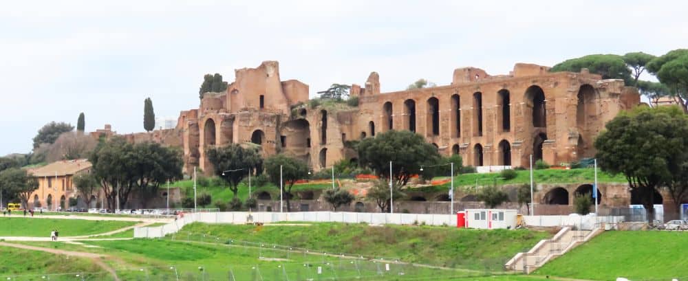
- The Villa di Massenzio and the Mausoleum of Maxentius (a.k.a. Mausoleum of Romulus): ruins of the grand villa of the Emperor Massenzio (4th century AD), along with the family mausoleum and a circus (chariot racetrack). Website.
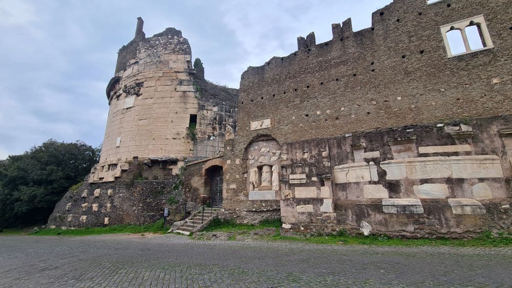
- Tomb of Cecilia Metella: Built in 30-10 BC, this tomb of a prominent noblewoman became part of a medieval castle in the Middle Ages. A visit to this site is partly about the original cylindrical tomb and partly about the medieval castle. We enjoyed a VR-presentation that showed what the castle and the complex around it looked like. Website.
- Capo di Bove archaeological complex: ruins of a 2nd-century AD bathhouse, with mosaic floors. This was under restoration when we visited, so we only got to see the garden around it and a small exhibition. Website.
- Villa Livia: an excavated villa that belonged to one of Emperor Augustus’s wives. Contains some mosaics and frescoes. Website.
- Santa Maria Nova Archaeological Park: various remains from the Roman era, the highlight being some well-preserved mosaic floors. Website.
- Villa of the Quintili: A Roman residential complex from the 2nd century AD. We were surprised at the size of these ruins, from a villa that was mostly from a later date to extensive Roman-era ruins of several buildings that made up a bathhouse – with an aqueduct to supply the water – a theater, and even a hippodrome. Website.
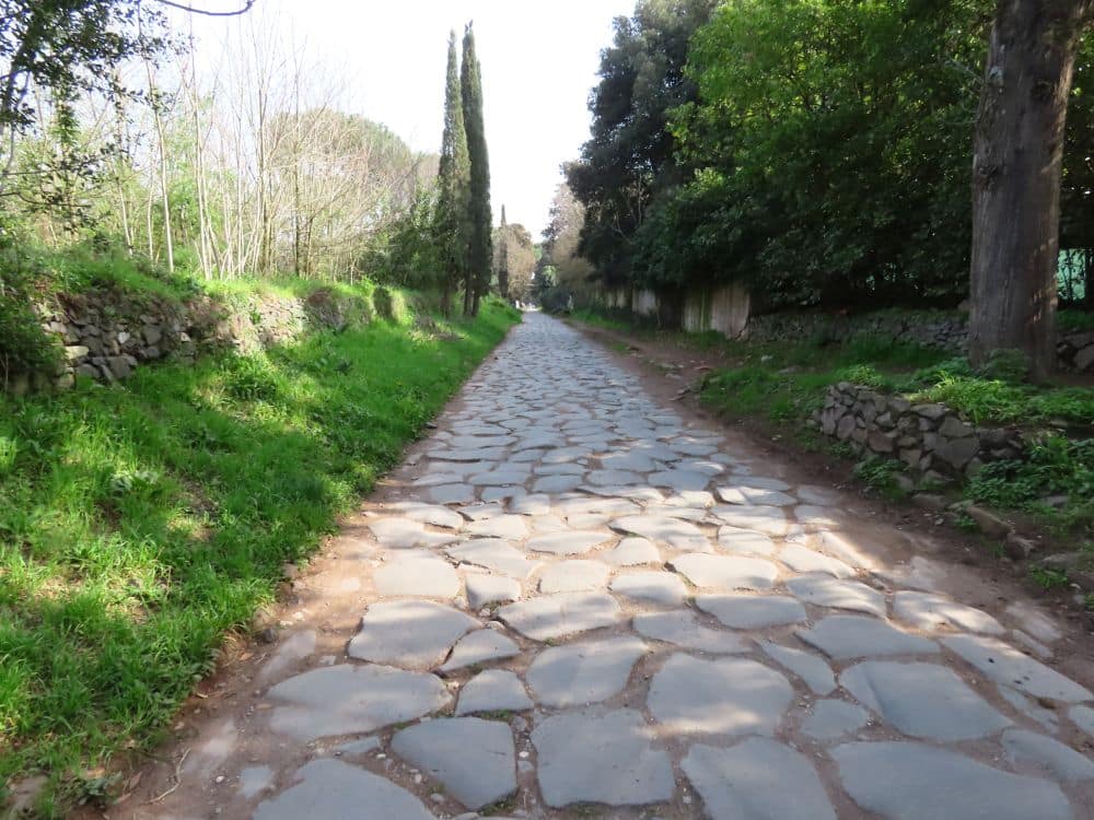
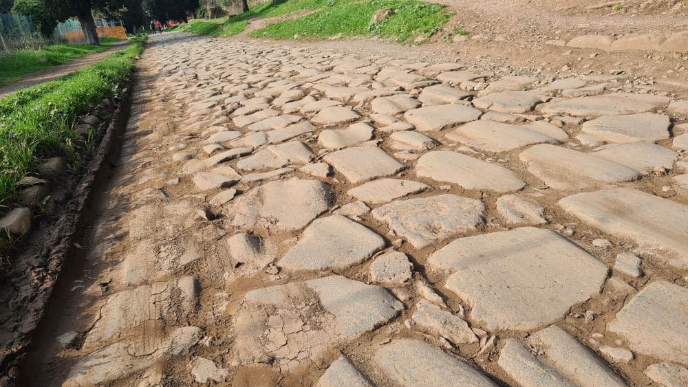
If you’re looking for original Roman-built Via Appia road, there are several stretches of it in the first few miles. Use this map, where the original road sections are marked in brown.
Keep in mind, though, that the road was smoother when it was built. The stones were set on a prepared bed of sand, mortar and gravel, and they were cut to fit very closely together, with cement between them. Over time the cement is long gone, and they’ve been damaged, perhaps shifted. Carts gradually cut grooves into them. On either side were drainage ditches with retaining walls, as well as sidewalks of packed dirt.
2. Across Alban Hills
We didn’t get to see it, but a museum here in Nemi sounds interesting: the Museum of the Roman Ships. Originally created to hold two excavated ships that belonged to Caligula in the first century – which burned in a 1944 fire – it still looks at what is left of the ships as well as giving some attention to the local area during ancient Roman times. Website.
3. Unnamed site
I could not, from searching on a map, figure out what this unnamed part of the site refers to. It seems to be in the area south of San Gennaro train station.
4. Unnamed site
Near this site – also unnamed on the UNESCO list – are some arches from a Roman bridge that carried a side branch of the Via Appia over a river. They’re called the Arches of San Lidano. We didn’t stop to see them, so I can’t vouch for whether they’re worth seeing or not.
5. Terracina and the crossing of the Lautulae Pass
High up on a hill is a long portico, still mostly intact, that once supported the Temple of Jupiter Anxur at the highest point of the hill. Only the base of the temple remains, as well as that of a smaller temple. A medieval monastery was later built on the site, and that is mostly in ruins as well. The views from this hill, though, are breathtaking, so visiting might be worth it just for that. Website.
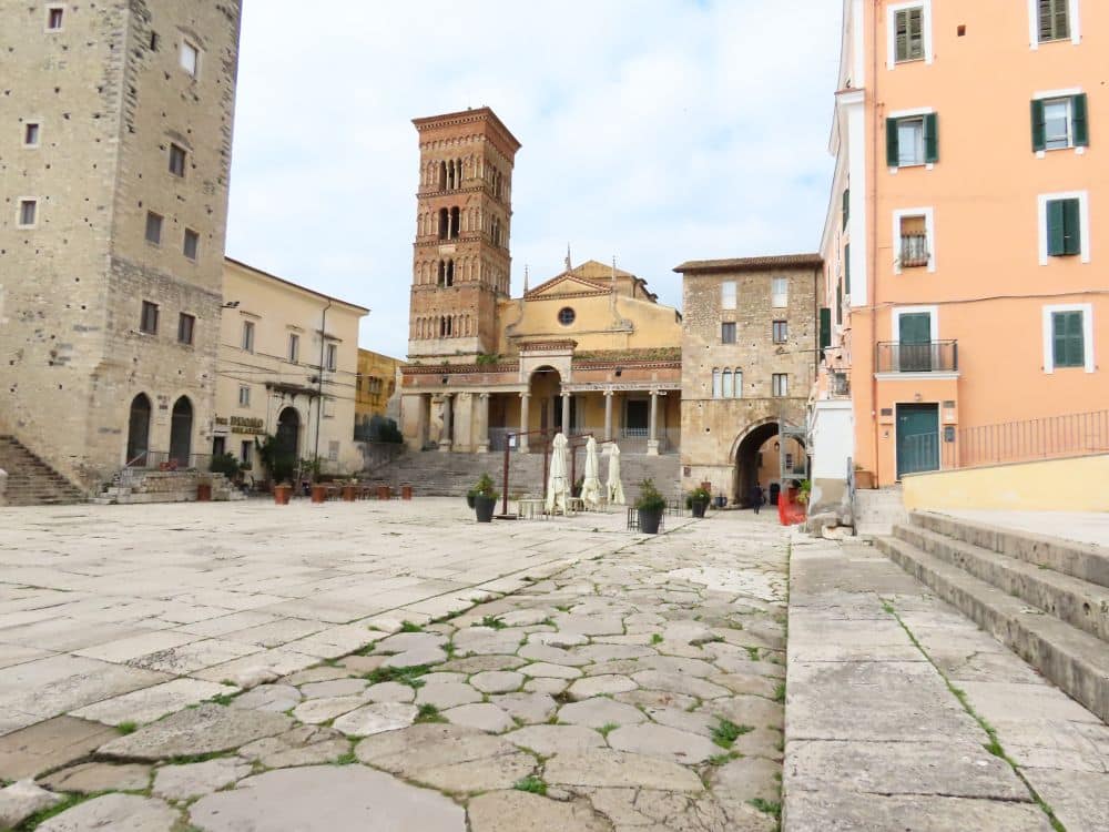
Below, in the town of Terracina’s old center, you’ll find the charming Piazza del Municipio, a plaza that incorporates a piece of the original road, as well as the ruins of an amphitheater. The large church on the plaza sits on the base of the Roman temple that preceded it, and incorporates the Roman temple’s pillars along its front portico. Just around the corner from the plaza is another small piece of the road topped by an arch from the Roman period: once the entrance to the Forum (marketplace) on the plaza.
Find accommodations in Terracina.
6. The Via Appia in Fundi
This is another that we did not get to see, but just outside the town of Fondi is the ruin of a Temple dedicated to Isis, an Egyptian god adopted by the ancient Romans. In Fondi’s old center you can find a Roman gate called Portella.
The Appian Way climbs from Fondi past various remnants of mausoleums and villas to the ruins of a sanctuary dedicated to Apollo, overbuilt with a later fortress called Fortino di Sant’Andrea. The sanctuary dates to between the 4th and 1st century BC. The original Roman-built road extends for about three kilometers between Fondi and Itri, now protected in the Appian Way Park. It has the large paving stones and an original sidewalk on either side. Website.
7. At the Itri Pass
See the description of the Via Appia in Fundi above. Much of what is described there is actually between the two towns.
8. From 83rd mile to Formiae
Outside the modern-day town of Formia is the tall Tomb of Cicero, though it’s not absolutely sure that it’s his tomb. A wing of the town hall in Formia houses the National Archeological Museum of Formia. It has a number of locally-excavated statues. Website.
9. Minturnae and the Garigliano crossing
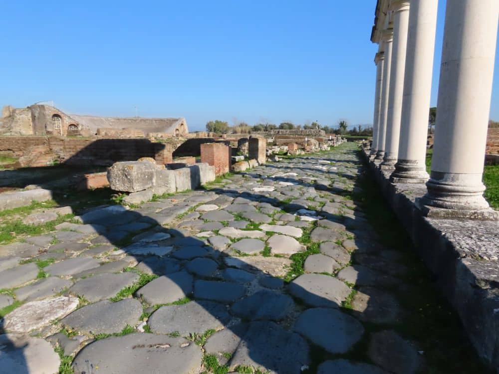
Minturnae was the town where the Via Appia crossed the Garigliano River. At the Minturnae Archaeological Park, we saw some clear sections of the road itself, complete with ruts worn into it by carts. A small theater looks like it’s been restored for modern-day use, but there are also the ruins of a town: a forum, with small shops along the road – or rather the bases of their foundations – temples and baths. A small museum under the theater has statues and funerary markers, as well as one colorful large mosaic from the site. An impressive Roman aqueduct stands not far away. Website.
10. From Sinuessa to the Pagus Sarclanus
In the coastal town of Sant’Eufemia is the archeological site of Antica Sinuessa, as well as an underwater area of ruins. SInuessa was a port town on the route. However, these sites do not seem to be open for viewing. Instead, you can see some of what was found there at the Civic Museum of Archeology Biagio Greco in Mondragone. Website.
Also in Mondragone is Pagus Sarclanus, of which not much remains but the ruins of a house around a courtyard, and what was probably a temple. Next to it is a 50-meter piece of the original Roman road. It is near the Mondragone cemetery in the Triglione area.
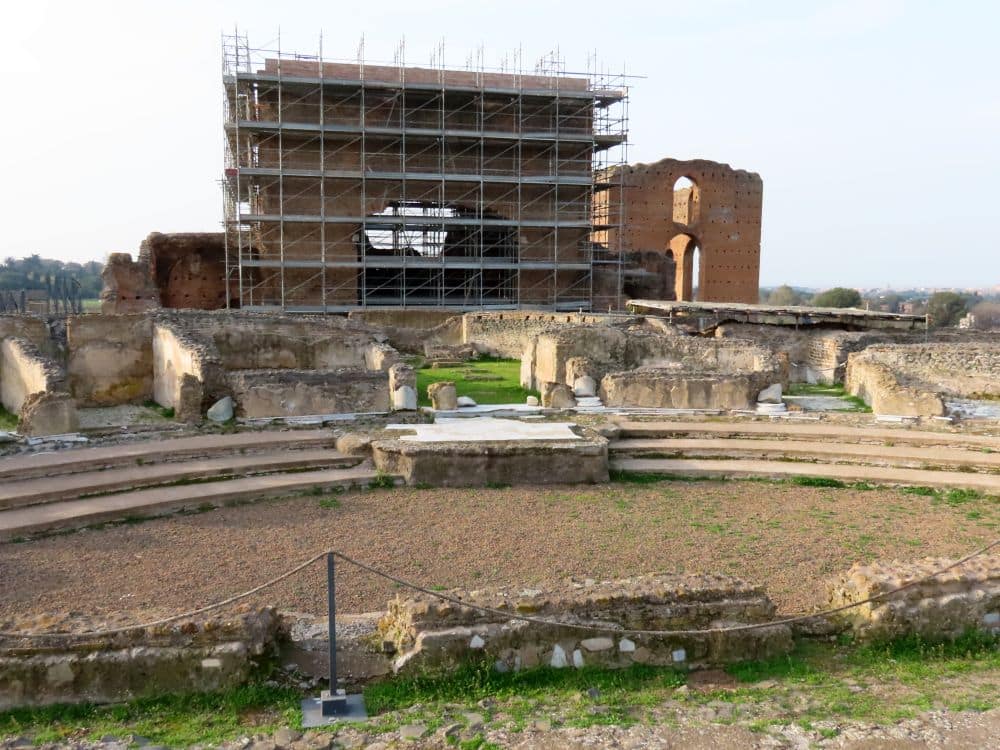
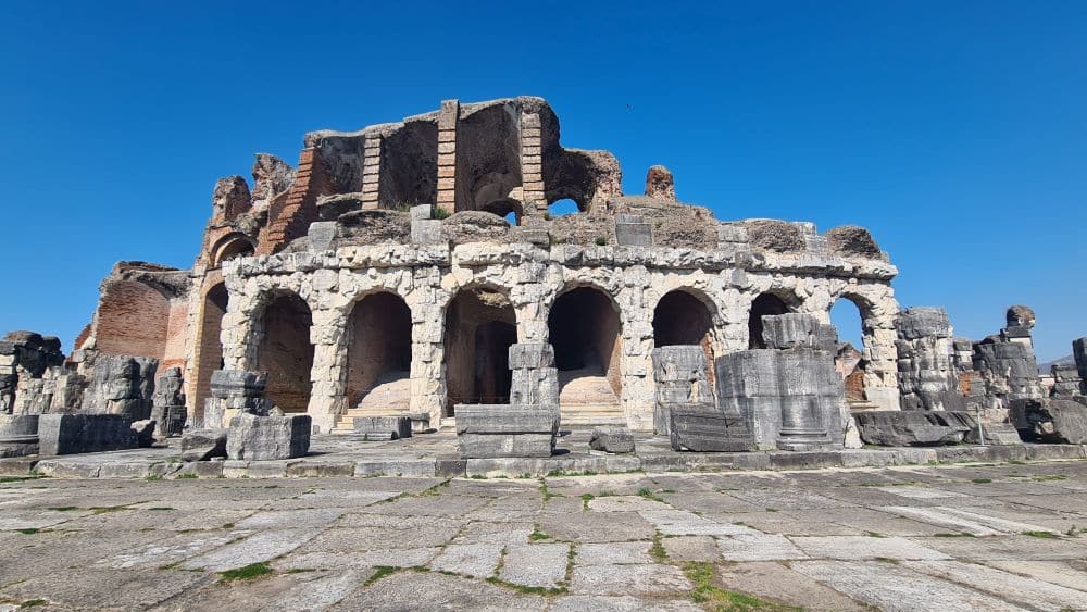
11. Ancient Capua
The Anfiteatro Campano in Capua was the second largest in Ancient Rome after the Colosseum. There’s not very much left of it, except some of the arches and seats. However, the underground complex, where the wild animals were kept and the gladiators prepared, are intact and interesting. There’s also a very small (3 rooms) museum about gladiators, with some interesting bas-reliefs from the site. Website.
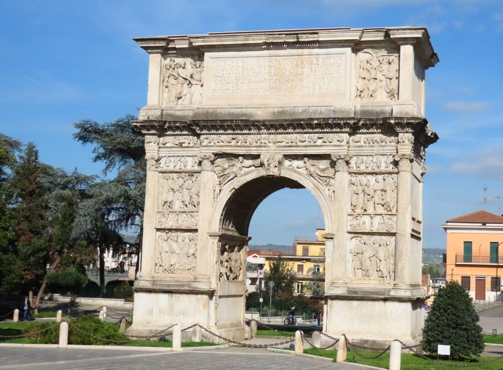
12. Beneventum and the Arch of Trajan
In the center of the modern-day town of Benevento is a triumphal arch that I think marks the start of Trajan’s extension of the Via Appia. The arch still holds some well-preserved bas-reliefs. We didn’t see it, but there’s also a Roman theater in Benevento.
Find accommodations in Benevento.
13. On the route from Beneventum to Aeclanum
Here, the Ponte Rotto, which means “broken bridge,” is indeed broken. There’s much less of it left than at the Ponte delle Chianche (Number 18 below).
14. In the upper Bradano Valley
This section has a number of sights related to the Roman road. At the Archaeological Park of Venosa, you’ll find the ruins of a bath complex, various residences, and a Roman amphitheater. The National Archeological Museum of Venosa tells the local history, with attention to the Roman period. And Melfi Castle‘s Archeological Museum in the nearby town of Melfi displays some local Roman-period art. Website.
15. Tarentum
Spartans colonized the island of Tarentum in the 8th century BC, and the Romans conquered it in 209 BC. In the modern-day city of Taranto, the Archaeological Museum of Taranto‘s collection illustrates the city’s Spartan and Roman history. Website.
Remnants of the Spartan period include a temple with two very early Doric columns and sections of the ancient Greek wall on the eastern side of the city.
As for the Roman period, you can find some remains of an aqueduct a couple kilometers north of the city. The Ancient Athlete’s tomb in the modern part of the city to the south dates to the 5th century BC, but there are later tombs in there from the Roman period as well, some of which are still painted.
Find accommodations in Taranto.
16. From Mesochorum to Scamnum
Between modern-day Latiano and Mesagne is the Muro Tenente Archaeological Park. Muro Tenente is possibly the site of Scamnum, and excavations there are ongoing and open to the public. It seems to have been a Greek-era settlement that may have been on the route of the Appian Way. Once the Romans arrived, the town seems to have declined and eventually disappeared. Website.
17. Brundisium
Brundisium, now called Brindisi, was the end point of the Appian Way. A busy port to this day, Roman soldiers and, later, Crusaders left from here to points east. The end of the route is marked in the old city by two Roman columns at the top of a wide staircase. Only one is still intact.
The San Pietro degli Schiavone Archaeological Area is under the Verdi Theater. It consists of the ruins of a Roman town, with mosaic floors, a Roman bath, and various homes and other structures. Website.
Find accommodations in Brindisi.
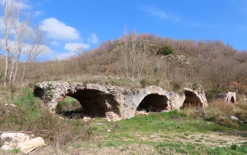
18. Appia Traiana from Beneventum to Aequum Tuticum
This is the location of a Roman bridge called Ponte delle Chianche. There isn’t much to do but see it and take pictures, but it must have once been a very impressive bridge crossing a valley.
19. Appia Traiana from Aecae to Herdonia
Aecae is today called Troia and Herdonia today is called Ordona. In between them, south of Foggia, is the Ponto Albanito, a bridge on the old Appian Way. Judging from what I have found online, not much is left of it.
Another bridge ruin, marked as Ponte Via Traiana di Herdonia, is nearer to Ordona in the middle of farm fields. On satellite view, it looks like a row of bridge supports survives, with perhaps one arch still standing.
The Ordona Archaeological Museum focuses on the archaeological site of Herdonia. The site, not fully excavated yet, has a wall with gates and towers, a forum, public buildings, temples, shops, a bath complex, an amphitheater and a necropolis. It is not clear to me if the site, which is just east-southeast of the museum, is open for visitors. From looking at the satellite view, it’s mostly only the foundations and bases of walls. Website.
20. Appia Traiana at Canusium and the Ofanto Course
We didn’t visit this one either, but an archeological park in Canosa di Puglia extends across the town and includes a number of sites: the Bagnoli Mausoleum, the Barbarossa Mausoleum, an arch that marked the Via Traiana’s entrance into the city, an early Christian baptistry, an early Christian basilica and, outside the town, a still-intact Roman bridge, and probably more. (See the map for locations.) At the National Museum of Archaeology of Canosa, you’ll see objects collected from excavations in the area, especially the various tombs. Website.
Outside of Barletta is the Antiquarium e Parco archeologico di Canne della Battaglia. This is the site of a famous battle between the Romans and Carthaginians in 216 BC. The ruins date back to the Bronze Age and up to the Middle Ages. From the satellite view, they look quite extensive, with the base walls of many buildings, plus a wall around the hilltop site. Website.
21. Appia Traiana along the Adriatic coast, through Egnatia
This stretch of the Via Traiana along the coast links Herdonia (Ordona) to the coast at Bari or Brindisi. It seems like the highlight of this stretch of road is at Egnatia, home to the National Archaeological Museum and Egnazia Archaeological Park in the modern coastal town of Fasano.
Right outside the site of ancient Gnathia, the museum gives the history of the site through a large collection of artifacts. It also has a section about underwater archaeology.
The archeological park itself includes defensive walls, a necropolis, an amphitheater, temples, baths, Roman and early Christian buildings – public and private – and an intact section of the Via Traiana. There are also two early Christian basilicas. Website.
Tips for visiting the Appian Way sites
As I mentioned above, it’s probably not worth trying to visit them all, or even as many as we did. Instead, you’ll get a good idea of it just from the Rome section.
Download a guide to the Parco Archeologico Appia Antica in Rome and a map of the park.
What the Rome park’s website recommends is that you enter via the road to the San Callisto Catacombs and then turn into the park’s territory. We didn’t realize this, so our first attempt involved much too much walking on the beginning of the Via Appia, a surprisingly busy street with minimal sidewalks. On our second attempt we approached the midpoint of the park from the Arco di Travertino metro stop, but that still meant a lot of walking just to get to the park.
Your best bet is to visit the sites along the route by bike or e-bike. With a bike you can travel the whole Appian Way in the park. The original Roman road with its big basalt blocks and the newer stone paving on most of the road are very bumpy, so make sure to rent a dirt bike with wide tires. There are dirt paths for most of its length along the sides, so you don’t have to bump over the paving stones all the time, but even the dirt paths are bumpy.
To learn more about what you’re seeing along the Rome section, consider taking a tour by bike, e-bike or golf cart.
For any of the sites listed above, check their websites to make sure they’ll be open. Many museums in Italy are closed on Mondays.
Wear good supportive shoes. Some of the locations are not at all set up for visitors, so you might have to walk along muddy or rocky paths to get to them. Even when they are set up for tourism, the paths are often rough, and so is any section of original Roman road you might walk on.
If you’re traveling in the summer, it’ll be hot at any of these sites: very hot. Go early in the morning or in the late afternoon to avoid the worst of the heat. Wear a sunhat and sun lotion, and bring water to drink. Many of these sites have no services; a few have a café or gift shop.
Not much of the Appian Way in Rome is wheelchair accessible except the road itself, which, as I mentioned, will be very bumpy in places. Some parts of it are in use, so you’ll be contending with traffic. Check each sight’s website along the way to see to what extent they can accommodate you. At other locations besides Rome, many of the archeological museums are wheelchair accessible, and the larger Roman-era town sites like Terracina, Minturnae and Capua will be at least partly accessible. Again, check their websites.
Where are the Via Appia and Via Traiana sites?
The sites extend from Rome to present-day Brindisi. You could see the sections in cities easily enough by train or bus – Rome, Benevento, Capua and Brindisi, for example. Use Omio to look up and book travel by train or bus. A car, though, makes more of the sites reachable.
If you’re renting a car, here are a few tips:
- Ask the rental agency about whether the car has a Telepass. It makes going through tolls much easier, since, in our experience, the machines often don’t work correctly.
- Get full insurance coverage with no deductible. Outside the toll highways the roads range from halfway decent to downright terrible, with lots of potholes and patching. Don’t take the risk of having to pay for damage to the car or tires.
- Some of the more extensive sites charge admission but also have parking lots. Others don’t. If you need to find parking on city streets, you should know that white lines are generally free parking spaces, while blue lines mean you have to pay by the hour. Have coins ready to use the nearest parking machine. In our limited experience, the parking machines don’t accept cards of any sort, even if they say they do. Alternatively, download the Easypark app, look for the nearest parking ticket machine, and use the number on the parking ticket machine to let the Easypark app know where you are. The app takes the money off your credit card, and you can set it for how long you want to stay. You can even extend your stay without returning to your car.
- Stay alert as you drive. We found that many drivers ignore things like stop signs and speed limits.
If it’s not a priority for you, just stay in Rome and take a long walk or bike ride in the archeological park. Find accommodations in Rome here.
While there does not seem to be an official website for the entire Via Appia set of locations, you can get more information about the Rome part of the road, the opening hours of the various things to see there, and admission fees, from the official website of the Appian Way Archaeological Park.
Have you been to any of the parts of the Via Appia or Via Traiana? If so, do you have any additional information or advice about this UNESCO World Heritage site? Please add your comments below!
- About the author
- Posts by this author

Rachel Heller blogs at Rachel’s Ruminations, a website focusing on historical and cultural sights/sites for independent travelers. She is also the owner of this World Heritage Travel website.